2,006.1 Miles: Stratton, Maine
2,006.1 Miles: Stratton, Maine
The final countdown begins...

Hey y’all! Back again with my second to last update— as of writing I have officially 188 miles left to go. Which feels simultaneously like an ocean away and like a blink of an eye.
Since the last email your way, I made a conscious effort to slow down a bit and marinate in the experience before it’s all over. I spent a zero day (when you hike zero miles on a day off of the trail) in Rutland, Vermont shortly after sending my last post where I stayed at an iconic hostel along the trail infamous because it’s run by the Twelves Tribe (a cult). A bunk and breakfast are completely free. Clearly, with many folks uncertain about their post trail plans, often young, and searching for something, A.T. thru-hikers make a promising bunch if you’re recruiting for a cult. Despite joking with friends that I am awfully susceptible to advertising, I thankfully ate a few great sandwiches and then hiked on.
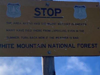
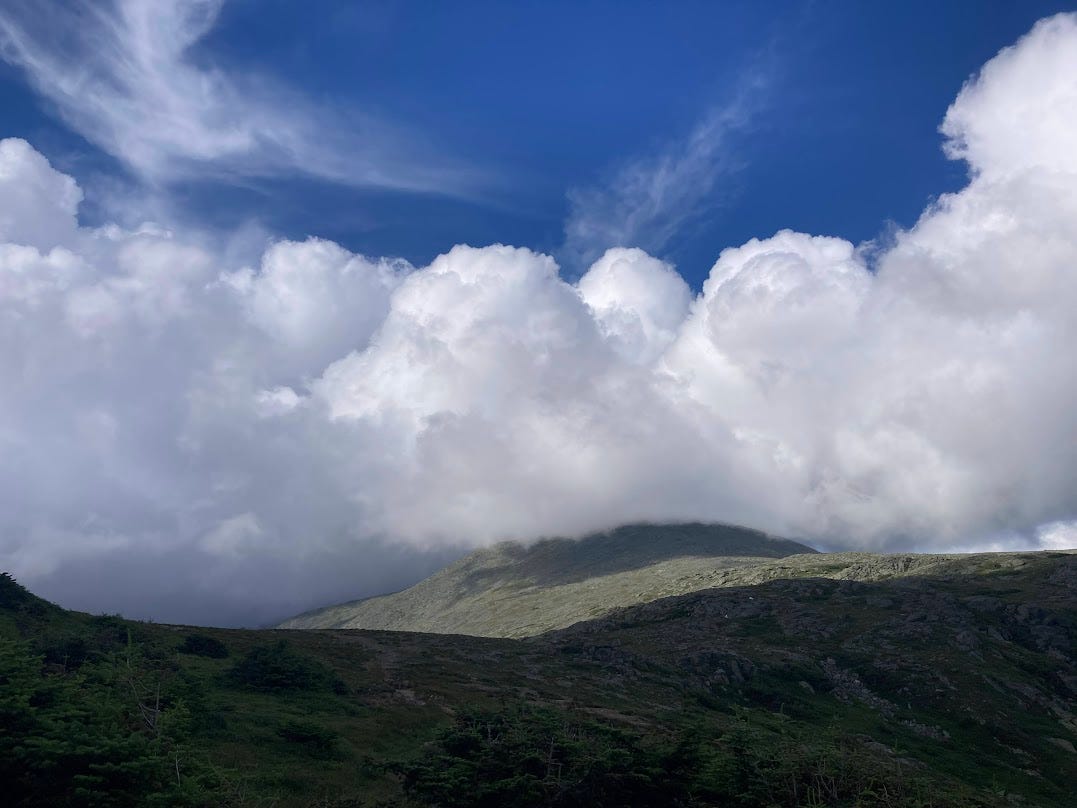
The second half of Vermont was less magical than the first I wrote about last newsletter and it felt like the White Mountains were ever looming in the distance, waiting to be conquered. All throughout the trail, we’d heard of the terrain in the White Mountains, steep, rocky, difficult and often in thunderstorm conditions. To date, two hikers this past year have died on Mount Washington due to hypothermia. The horror stories of hikers suffering injuries and even the images of the elevation gains and losses had the next section of trail shrouded in a villainous aura.
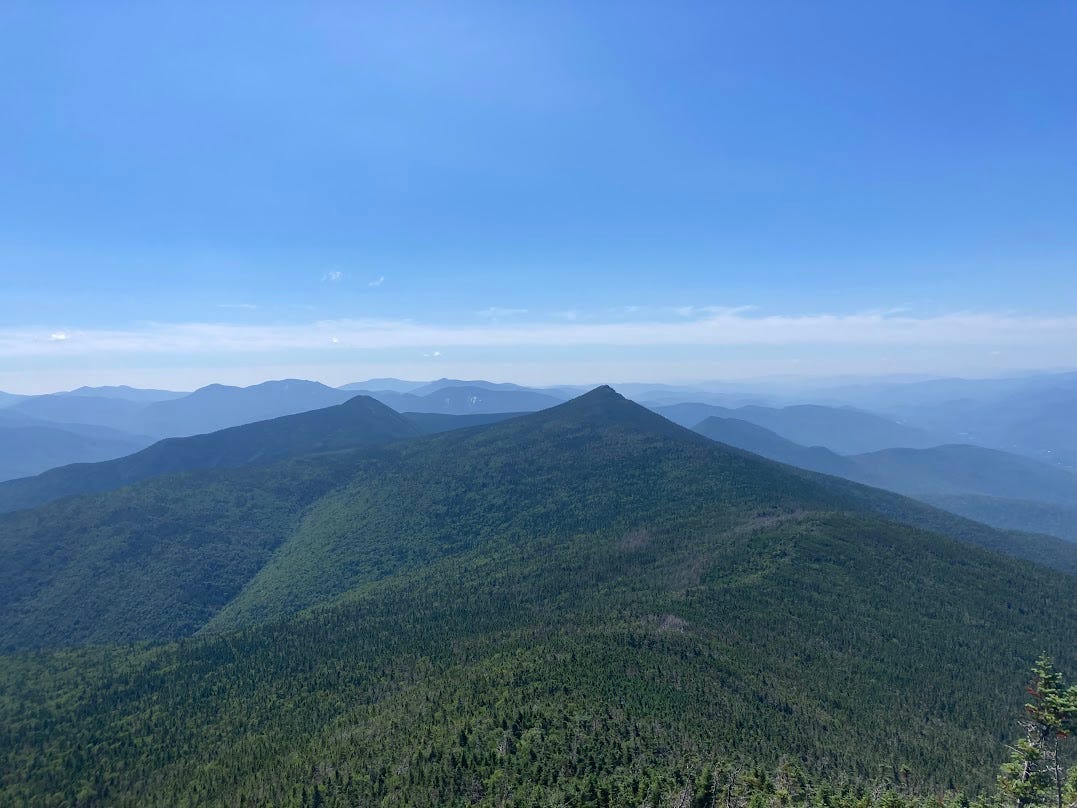
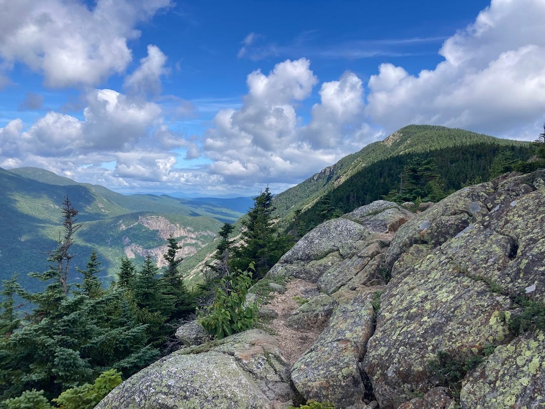
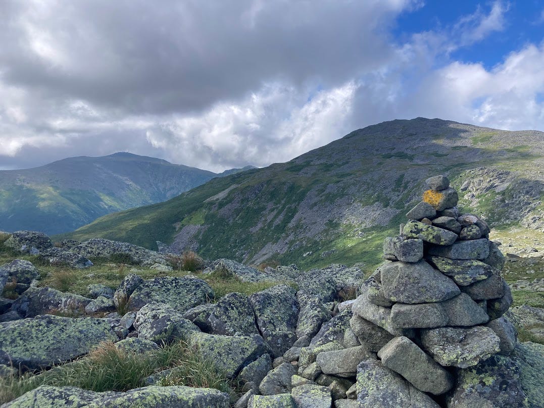
And then suddenly I was in the oft-fear mongered about White Mountains, climbing up rocks that I had to constantly put aside my trekking poles to use both hands and, as I was warned about my many a former thru-hiker, the trail radically changed. But while the challenge was upped, it was the views that were the most changed.
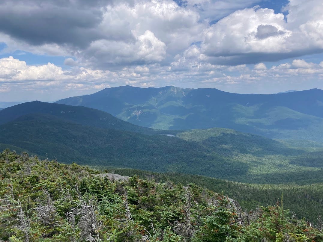
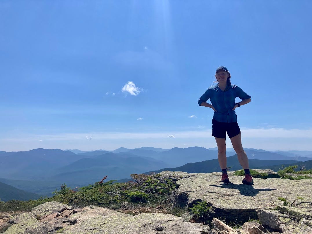
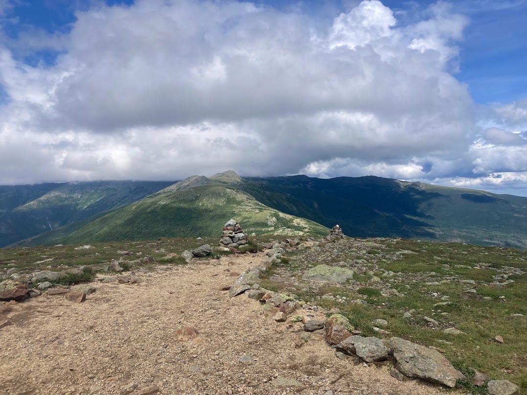
After hiking on the Appalachian mountain range for the past four-ish months, I felt that I knew the mountains. An odd thing to say perhaps, but I really felt like I knew what to expect of the range as a whole— I knew to expect their gradual slopes, the forested summits, the trail snaking up and down constantly through the green tunnel, I knew the moss on the tree trunks and the mud puddles after a storm. The Whites were not that. They were steep, awe-striking, bald summits. Rocky summits and steeper terrain. It honestly felt like someone had dropped a piece of near where I grew up (right outside of Yosemite National Park) onto the East Coast. They were stunning. And so even though the trail was hard, this section by far and away had the most incredible views.
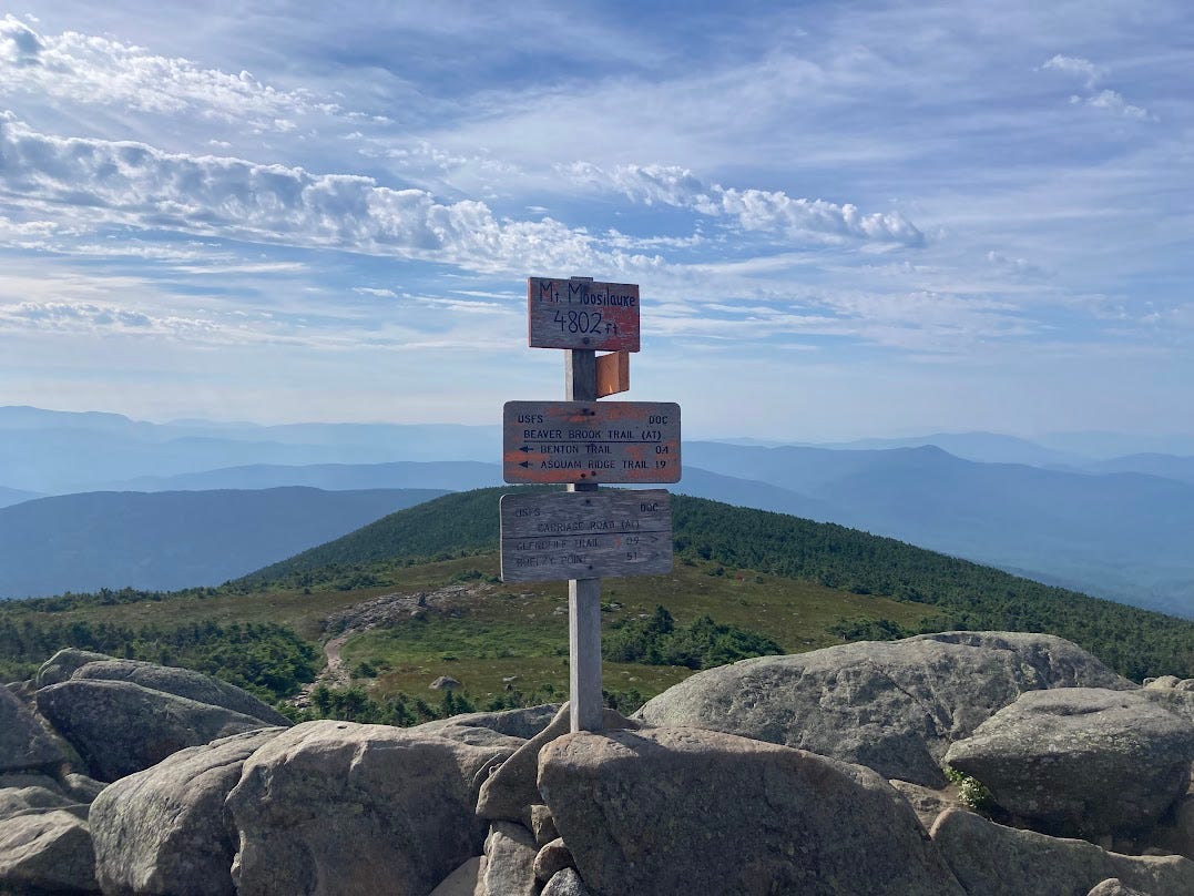
I first made the ascent up Moosilauke and felt strong, capable, and ready to tackle any ascent my way. All thru-hikers shorten their mileage in the Whites due to the more challenging terrain, so I paired back my miles and tried to pause to soak in the views. I continued to love the steep, hard ascents but the long, steep descents took a toll on my knees/feet/desire to hike.
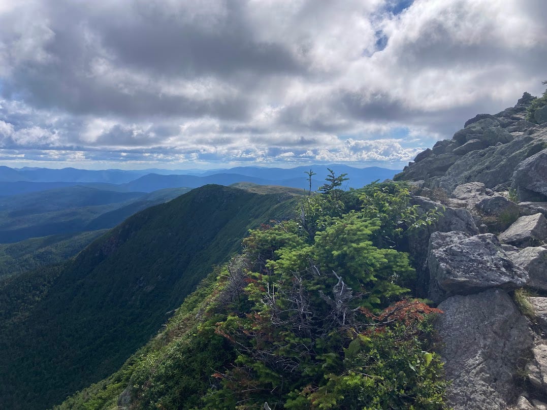
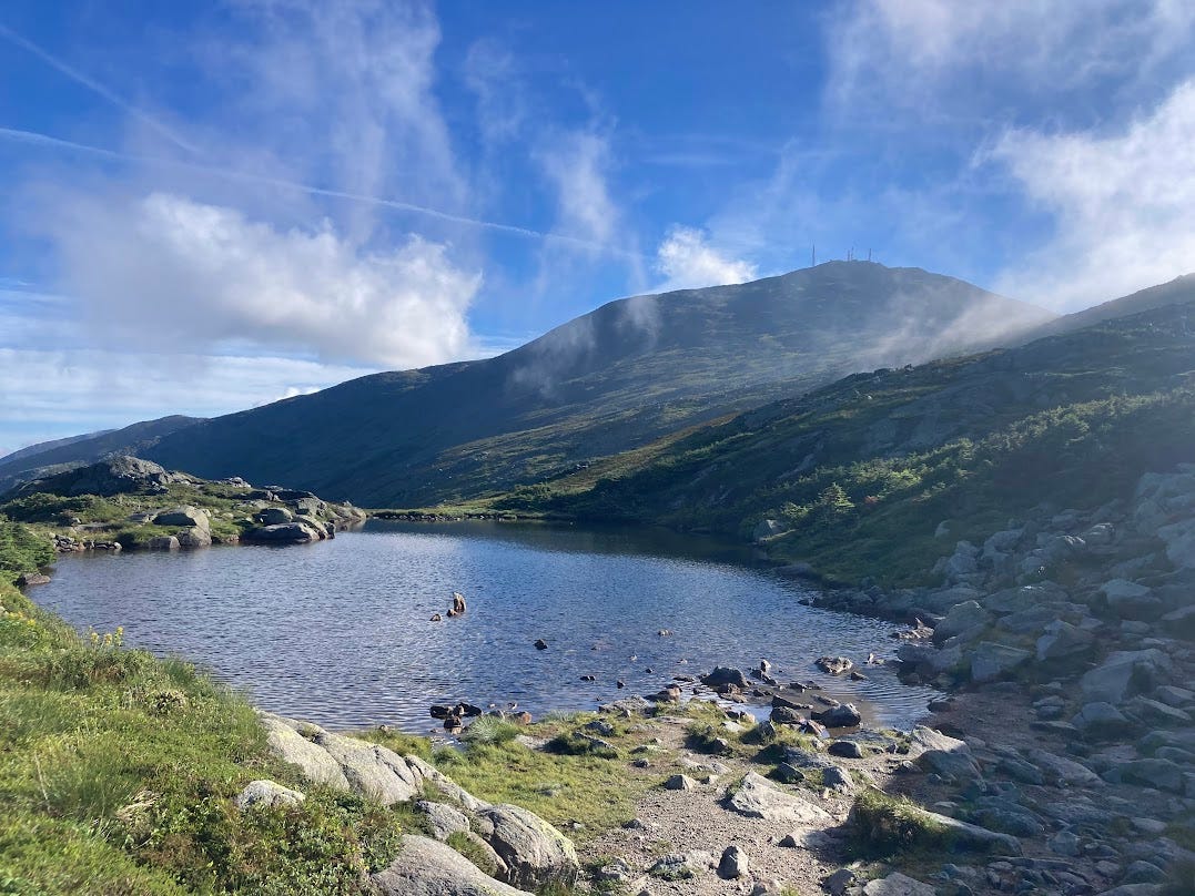
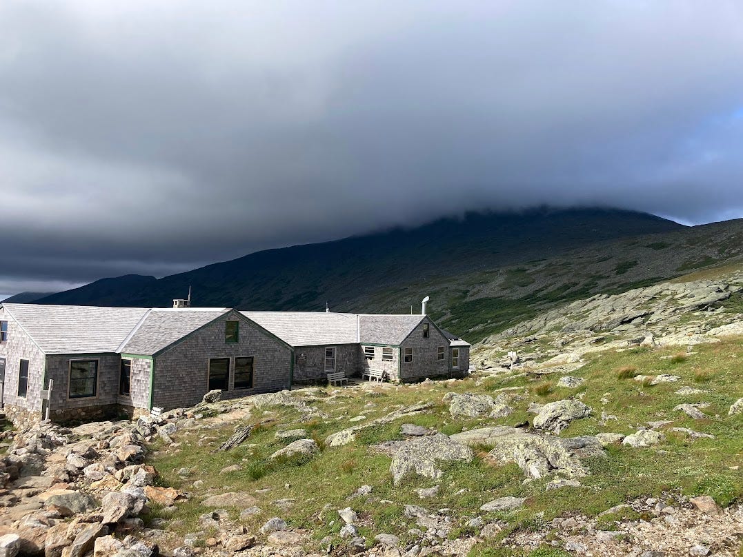
I dodged thunderstorms on the exposed ridge by timing my ascents and descents and visited the “Huts” (glorified bunkhouses scattered in the mountains that were chock full of families and quite bizarre to encounter) for baked goods and bowls of soup.
While for the other nights I camped in my tent, I chose to embrace the odd experience that is staying in a “Hut” and booked one night at the Lakes of the Clouds Hut. The feel was far more “summer camp” than thru-hiker, but I was positioned well for an early morning hike up Mount Washington with clear skies and a gorgeous view. The Presidential Range in its entirety blew me away (both figuratively and nearly literally with the wind).
Around the time of making my way through the Whites, I also came across my first bunch and then a steady stream of Sobo (shorthand for “Southbounders”) hikers moving from Maine to Georgia. Each encounter was a reminder of how far I’d come and a chance to peak into the crystal ball with my future— was the upcoming water source dry? How was this or that town for re-supplying? I found myself having lengthy conversations with each one and then we’d say goodbye, part ways, and (unlike Northbound thru-hilkers that we continually run into again and again up the trail), I’d know that I’d never see them again.
In college I took a class on French Surrealism (because why the hell not) and my professor explained that the Surrealists were obsessed with the concept of sudden and fleeting encounters that modern life created, called “coup de foudre” translated as lightening strikes in English— ex. seeing someone in an opposite metro car only for a moment before the trains pulled in different directions. Every time a SOBO walks past after a brief encounter, I think of this expression.
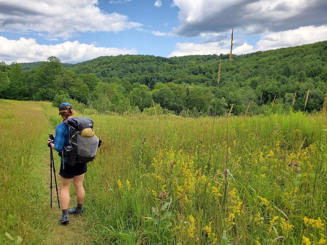
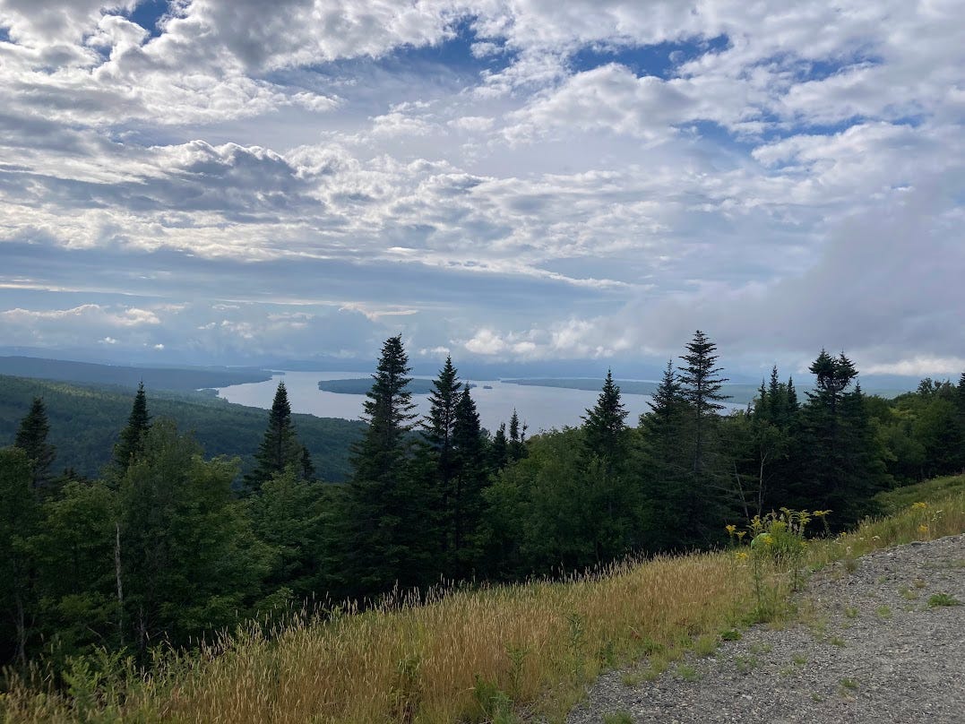
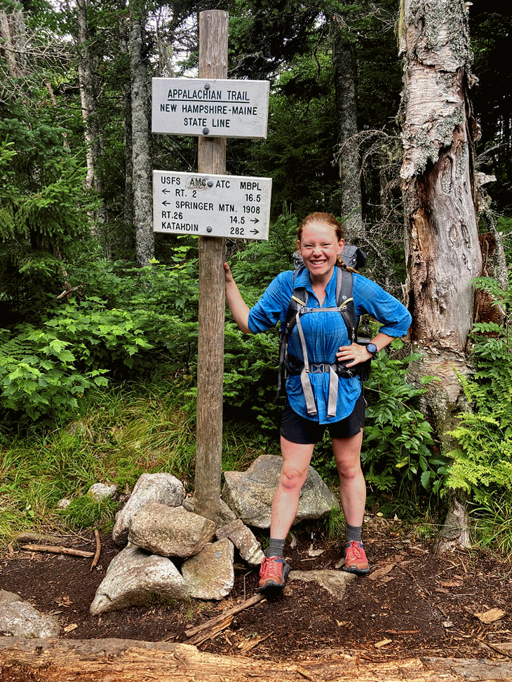
Finally, I entered Maine through a series of boggy mud puddles of trail. Almost in an effort to warn hikers that the last state wouldn’t be easy, the first few miles of the state had me scrambling over rocks, forcing my shoes through inches deep mud, and steep declines. But I’d made it to the final state of Maine so didn’t care that I had mud-covered shoes that slid down rocks for days and the lakes, ponds, and gorgeous mountains immediately competed with Vermont and New Hampshire in beauty. And (or so I’ve heard from Sobo’s!), the state only progressively gets more astonishing as I head up to Katahdin.
Notable Low Points:
When I first started, I assumed that as you hiked up to Maine you’d naturally get stronger and in better shape for hiking. This held true for perhaps the first 1,500 or so miles. Since then, like a car with too many miles over the years, every hiker I’ve been around shares the sensation that we’re playing whack a mole with pain. My feet will hurt, then my knees, then my back, then my feet and every morning my body screams at me to not move. Two days ago, I was moving at such a slow pace I think “zombie-ing” would be a better verb than hiking as my feet trudged up the trail with little energy. I’m honestly not sure if humans are built to walk this far and it’s taking a toll.
In a lesser low point, in this last stretch while filtering water I dropped my charger bank that keeps my cell phone charged for taking photos, listening to music, etc. Since then I’ve had no podcasts, audiobooks, or music to breakup the hike mid-day and it’s certainly added a challenge. Fortunately, Henry sent one to my next re-supply, so hopefully I’ll be back to listening to music soon!
Notable High Points:
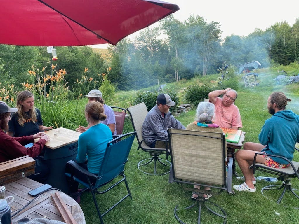
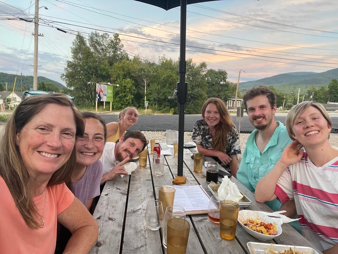
In an unexpected highlight this past stretch, one of my friends on trail, Roti, had a friend of a friend who lived on a small farm near Hanover, New Hampshire. After crossing the border into NH, a big group of us headed for a zero day and stayed at the farm, learned how to play a French-Canadian board game named Tuc, and ate Moose burgers.

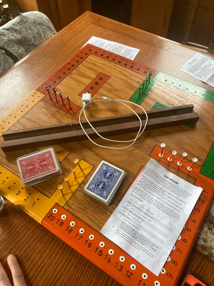
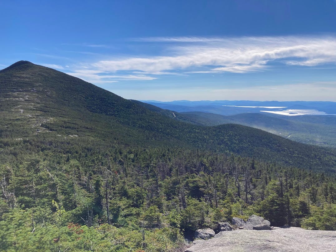
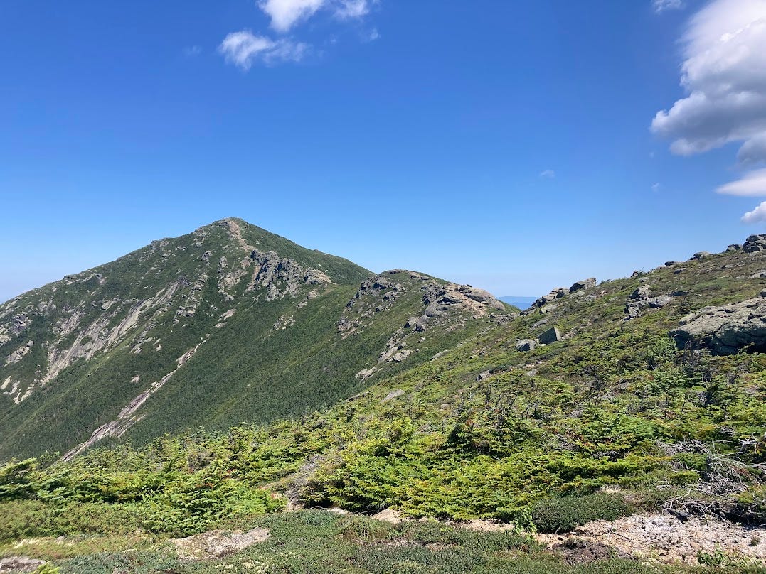
The board game Tuc! As mentioned above, the Whites were incredible. Traversing the Presidential Range and Franconia Ridge absolutely make my top five best hikes of my life (feel free to reply and ask what my other 4 are if you’re curious!).


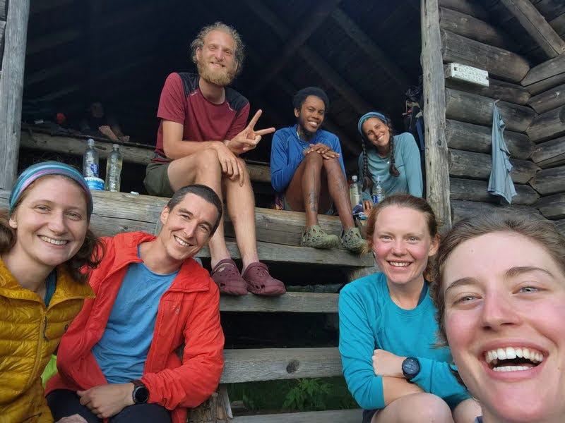
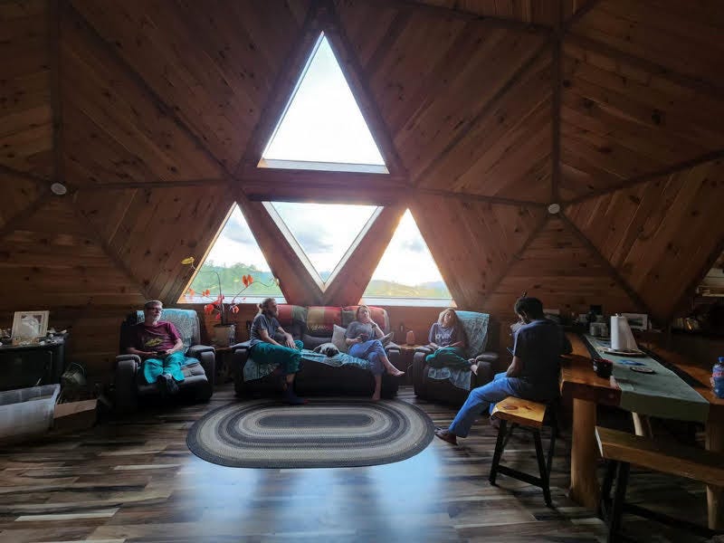
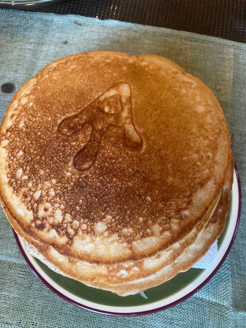
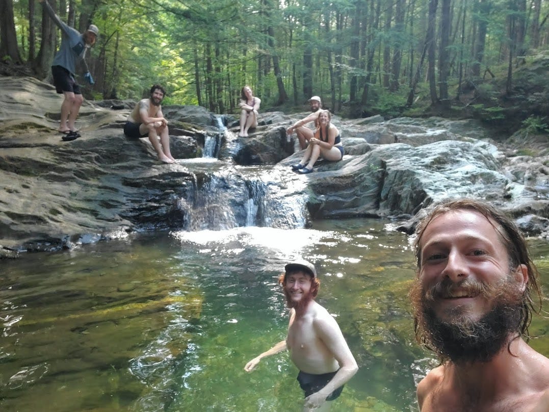
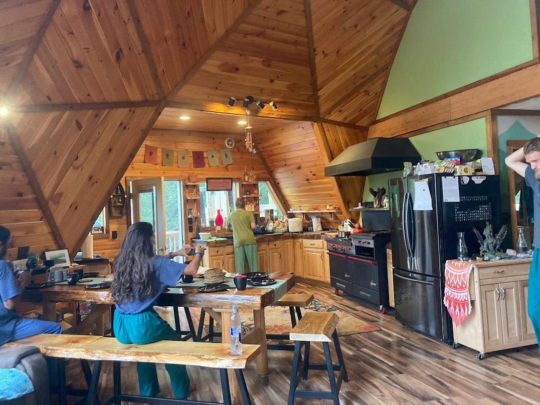
Celebrating the end of the Whites with Pilgrim, Trekker, Pocket Bagel, Juggernaut, Sunshine, and Daisy After the Whites, I stopped for the night for a shower, resupply, and laundry at Human Nature Hostel. The owner, trailname White Owl, built a geodesic dome from money he won after being on a grand total of 5 seasons of Naked and Afraid!!! Hearing his stories of being in the South African wilderness and being attacked by gators in the Everglades of Florida over pancakes was a fun way to start a morning hiking.

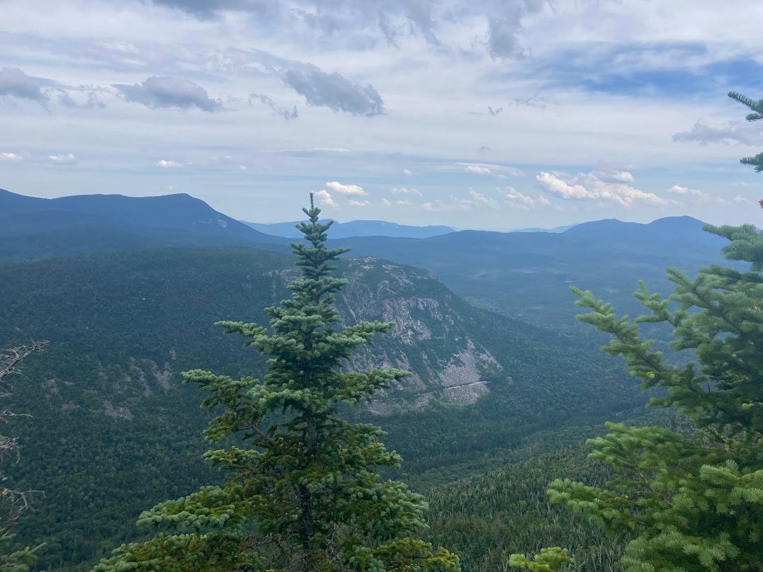
In this last section, I also completed what is called the “Hardest Mile on the A.T.” with Mahoosuc Notch— what is essentially a mile of straight boulders with nooks and crannies you wedge between. Worming my way through this part, I felt partially a rock-climber and partially a child again jumping back and forth playing a game of “lava”. It was incredibly fun. The stretch after, called Mahoosuc Arm, was a near vertical mile of uphill climb that was less fun. But I’d go back and face the Notch once more.

See the trail? Yeah, I didn’t either. 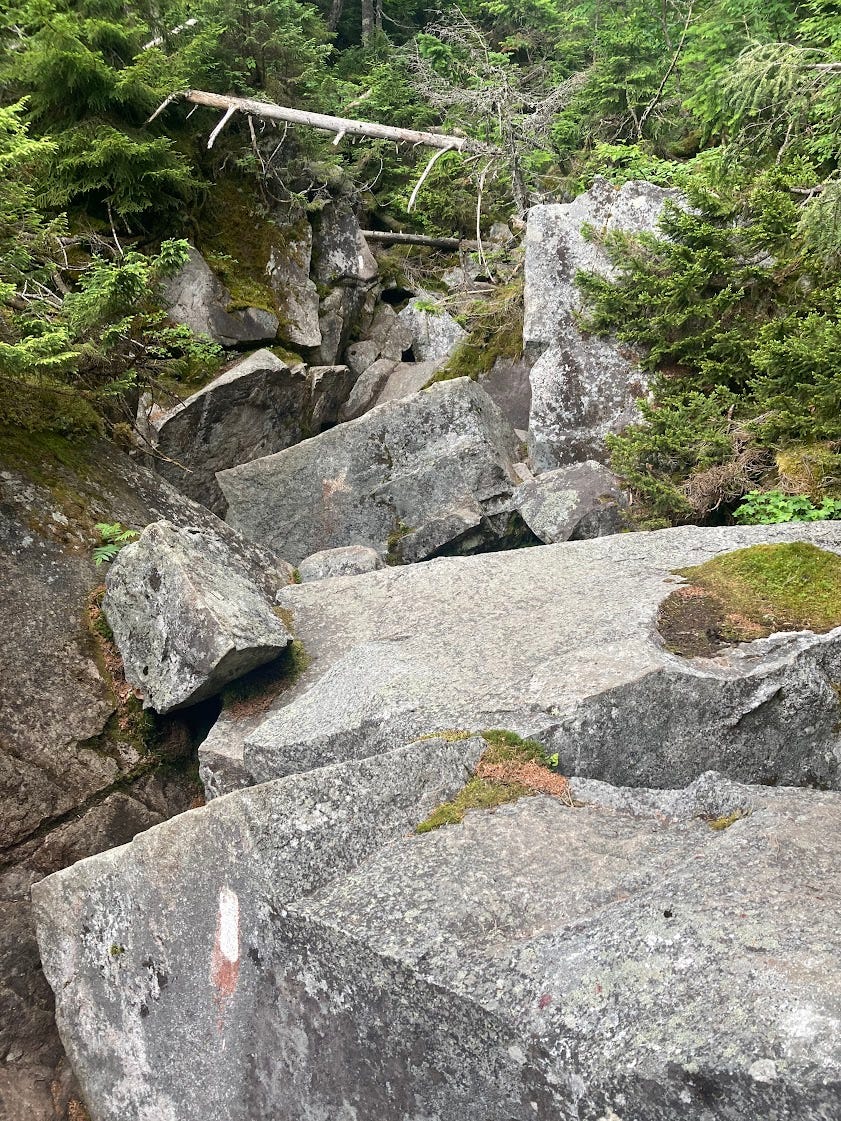
Again, how is this a trail? 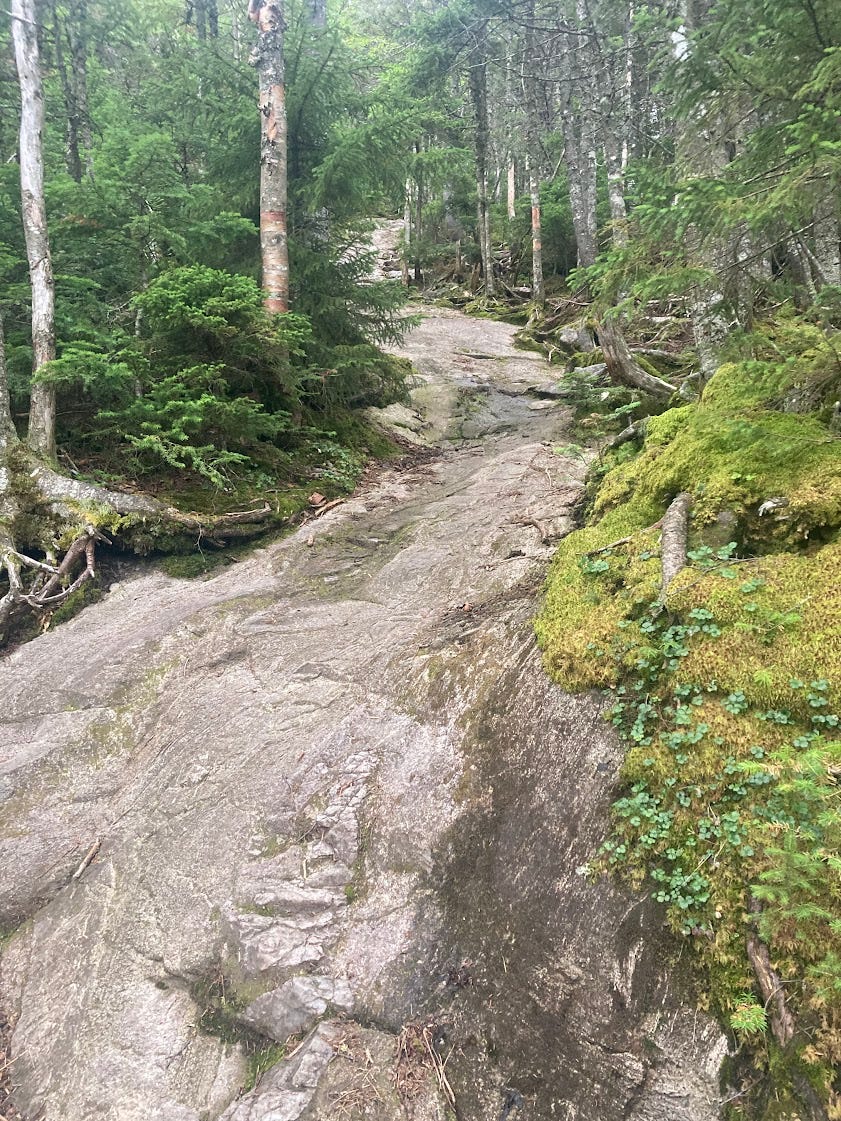
Looks like a stream of granite but actually it was a vertical section of slippery as hell, steep rock face at the very end of my day Finally, hitting 2,000 miles and the Maine border were both milestones that I’ve been dreaming about for years. Wildly exciting to be here.


Something I’ve Been Thinking About:
Hiking through the Whites in New Hampshire, I set up camp just after Franconia Ridge and was talking with a group of hikers about the incredible, but damn hard terrain of the past few days. One girl lamented, “I’d rather never see a view again than do another 3,000+ feet climb”.
I disagreed. In New Hampshire, Vermont, and Maine so far, I’ve felt motivated. It’s been incredibly challenging and, as mentioned in the low points section, I can certainly feel my body decaying under the constant stress, but I found myself more invested in hiking during the day-to-day than in previous states.
In Connecticut, in New York, and absolutely in Pennsylvania, I’d often feel demotivated and like I didn’t want to hike. Those states were arguably much “easier” and yet, for me, they felt much harder. The flatter terrain with fewer mountains and fewer milestones meant that my heart-rate stayed low but I felt almost bored with the act of hiking. With no mountains to climb, there was little reward.
While perhaps obvious, since that conversation I’ve been ruminating on how what’s hard isn’t always hard and what’s easy can actually be hard. The amount of people who quit in relatively gentle PA versus strenuous New Hampshire stand as a testament to that. I began thinking about the trail (and work and life more general) as being divided into a matrix with an X-axis of challenge and Y-axis of difficulty which each person having an affinity towards a particular quadrant of the matrix.
As the bonafide nerd I am, I actually set to work surveying hikers on their challenge/reward ratings for each segment of the trail and then mapped out the average response into a matrix.
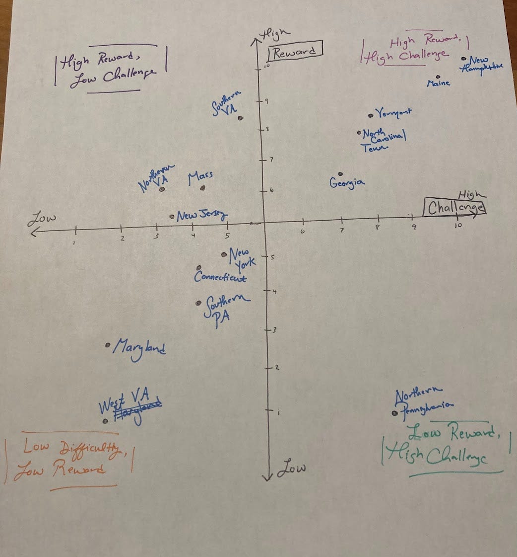
The states that I have enjoyed the most all followed the pattern of high challenge, high reward. Thinking back to previous circumstances, the classes I’ve enjoyed the most and the work that I have enjoyed the most all fit into that category. In my job before the trail, I often thought about how I felt most motivated embarking on something I’d never done before, when I needed to put in more effort and learn something new. High challenge, high reward. I’d notice others seeking out reliable outcomes with reliable inputs, patterns, and comfort in complete mastery of the skill, essentially the high reward, low challenge quadrant. Being on the trail reinforced my belief that in order to feel most engaged, I’d rather be climbing the mountain than sitting on it’s peak.
—
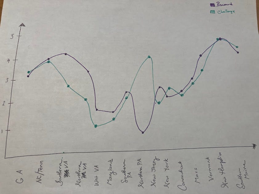
As a side note (again because I’m a nerd and enjoy creating graphs on my off days when I’m not hiking)— I also graphed the states across the trail and their reward and challenge measures. The representation clearly shows why Pennsylvania is so damn hard and a frequent location of people quitting. I also found it interesting that Georgia (perhaps because people are just starting), Pennsylvania, Connecticut, and Maine were the only places where the challenge curve was above the reward curve. Even nerder— you could even claim that the difference of the integrals of the two curves could represent the external motivation factor of each portion of the trail! Okay, done here.
—
And that’s a wrap for this time! Once again, thanks for reading and next time you’ll hear from me (fingers crossed!) I’ll have summited Katahdin! :)
Best,
Tierney // trailname: BeastMode
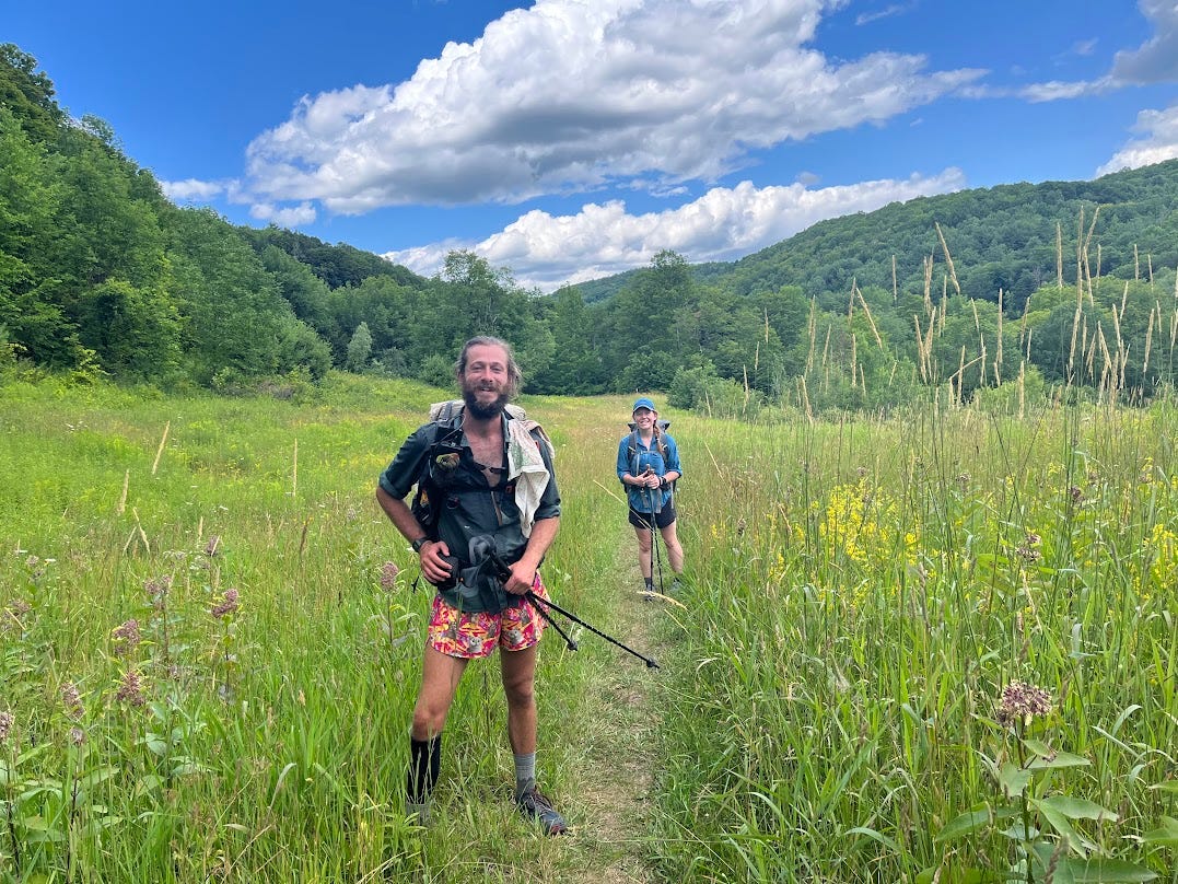
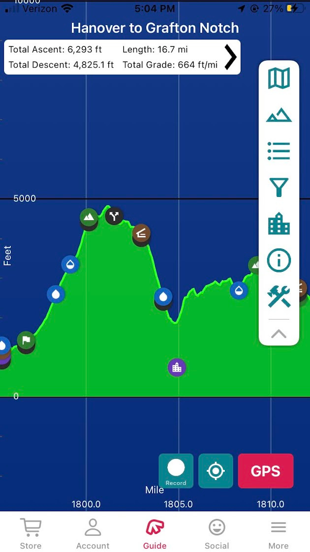
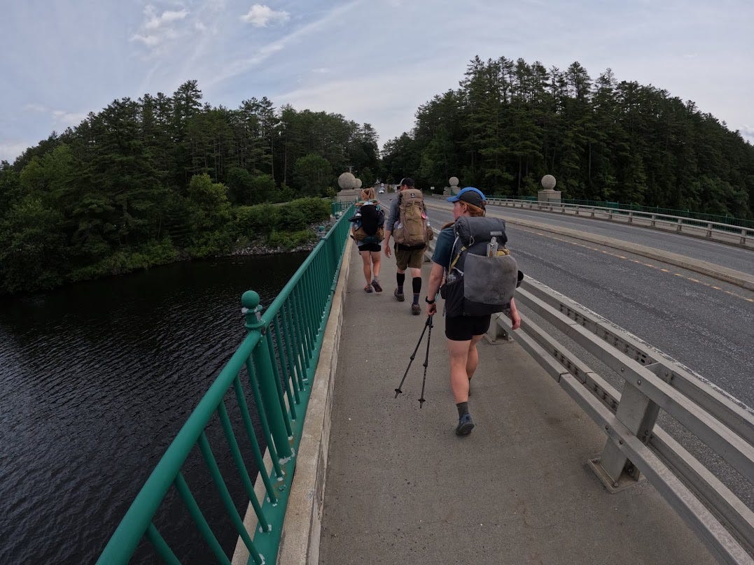
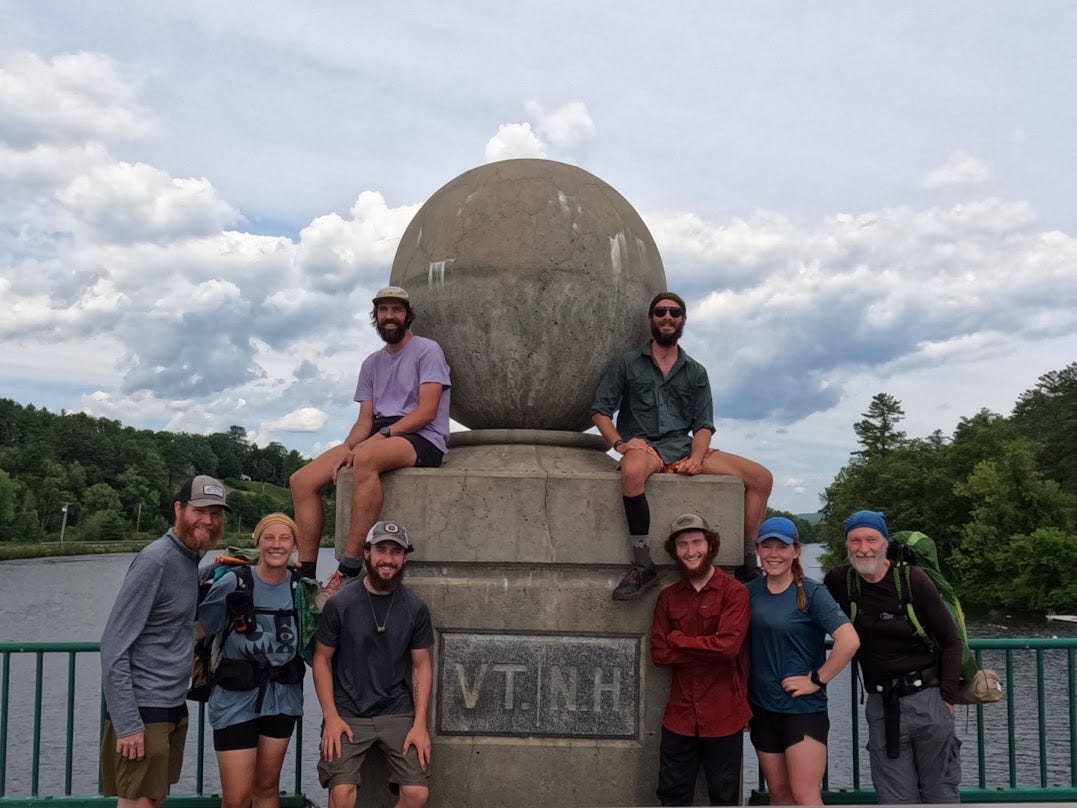
Photo Dump!